I climbed my first mountain on Sunday! Well, at 812m, it's just a small hill compared to the mountains of neighbouring La Réunion, but it's still the third highest peak in Mauritius behind Le Piton de la Petite Rivière Noire (828m) and Pieter Both (820m) It's a relatively easy climb, except the very last part, but should not be tackled, as we did it, after a heavy lunch!
The first part of the walk is a wide track through the sugar cane fields. Thanks to Pat and his penknife, we each got a piece of cane to chew on, giving us a sugar rush for the effort ahead.
This sign said it would take us over 2 hours to reach the summit less than 2km away. With all our water and photo stops, that was pretty accurate, but we could have done it in less time I think. We were lucky with the weather - it was sunny, but not too hot.
There was also this charming piece of graffiti with the message in Kréol to ask visitors not to turn their mountain into a dustbin.
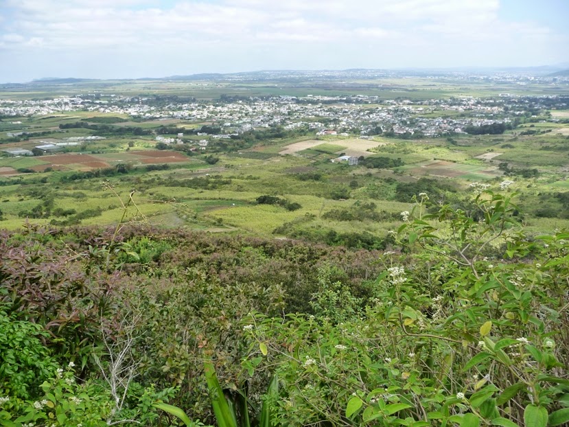
After the cane fields, there was a steeper, rocky path through some trees. It was well worth it though, as we soon arrived at the first viewpoint. This photo is looking south across the central plateau where the major towns are concentrated. There's Quatre Bornes, Beau Bassin-Rose Hill, Vacoas-Phoenix, and several other, smaller places. In terms of climate, it's the coolest and dampest part of the island.
We thought this would be a great way to get back to the car after climbing to the top, but unfortunately we didn't have the right kit for it and had to walk down.
After the first viewpoint, the scenery changes to this low scrubland. I didn't do my homework before going, but I've since read that there are many imported acacias and guava, native ebony and mahogany, and a critically endangered endemic plant called Le Pouce Mountain Screwpine. I'll look out for them next time.
The path opens out to a kind of plateau where you can rest before attempting the steep final section to the summit. From here, you get a great view of Pieter Both. (the one in the middle) The mountain is named after the first Governor-General of the Dutch East Indies because there's a giant boulder perched on the top and they think it looks like him. I've been reading up on it and there's no way I'll be climbing up to say hello! It sounds a bit too dangerous for me.
From the "thumbnail" or summit of the mountain, you can see all of Port Louis, the capital of Mauritius. It was a bit hazy so the photo isn't that clear, but you can still see the port itself, the towers of the town centre, and the Champs de Mars racecourse.
The way down was much easier, and we even spotted this small shrine which we had missed on the way up.
It was a good job we had a great day, great weather and beautiful scenery - it went a long way towards compensating for the pain in our legs the next day!


No comments:
Post a Comment